Himachal Pradesh is a state in Northern India. It is spread over 21,495 sq mi (55,670 km2),and is bordered by Jammu and Kashmir on the north, Punjab on the west and south-west, Haryana and Uttarakhand on the south-east and by the Tibet Autonomous Region on the east.
Himachal Pradesh is famous for its abundant natural beauty. After the war between Nepal and Britain also known as Anglo-Gorkha War, the British colonial government came into power. In 1950 Himachal was declared as a union territory but after the State of Himachal Pradesh Act 1971, Himachal emerged as the 18th state of the Republic of India. Hima means snow in Sanskrit, and the literal meaning of the state’s name is In the lap of Himalayas. It was named by one of the great Sanskrit scholars of Himachal Pradesh, Acharya Diwakar Datt Sharma.
The Economy of the Himachal Pradesh is currently the third fastest growing economy in India. Himachal Pradesh has been ranked fourth in the list of the highest per capita incomes of Indian states. Due to the abundance of perennial rivers, Himachal also sells hydroelectricity to other states such as Delhi, Punjab and Rajasthan. The economy of the state is highly dependent on three sources: hydroelectric power, tourism and agriculture.
Hindus make up 95% of the state population, making it the most Hindu state (proportionally), in India. It is the least urbanized state in India with nearly 90% of population living in rural area with Shimla district being highly urbanized with nearly 25% population living in urban area.
Places to visit :
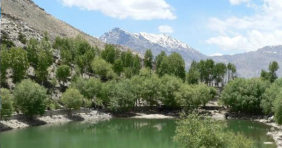
 Dharamshala, Originally a little hill resort built by the British, Dharamshala is now the main hill station in the Kangra Valley and is also the headquarter of district Kangra. Dharamshala lies between the Shivalik Hills and the foothills of the mighty Dhauladhars. Blessed with marvelous landscapes, Dharamshala is a travellers paradise—lofty snow peaks, deep gorges, lush green valleys, manicured tea gardens, wooded hills, gushing rivers, enchanting mountain lakes, flower-adorned meadows, beautiful temples and striking monasteries,
Lower Dharamshala (1,250 m)Dharamshala is divided into roughly two parts.
This is the busy commercial area with government buildings, the shopping centre and the bus stand
Upper Dharamshala (1,982 m)
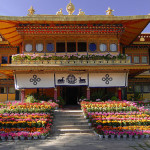
This part has suburbs like Forsythganj and Macleodganj where the celebrated Dalai Lama has settled in exile. It has a lots of Tibetan population and monasteries and looks like a Tibetan township.
How to reach :
By Air
The airport at Gaggal in Kangra is at a distance of 13 km, this is the nearest airport. There are daily flights from Delhi to this place.
By Rail
The nearest railhead is Pathankot, 90 km away. Pathankot is on Delhi Jammu Railway line and there are plenty of trains to choose from at different timings. It takes three hours from this place to reach Dharamshala.
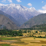 Palampur (1,219 meter) is a fascinating green hill station in the Kangra Valley, surrounded on all sides by tea gardens and pine forests before they merge with the Dhauladhar ranges.
Palampur is the tea capital of northwest India. But tea is just one aspect that makes Palampur a special interest place. Abundance of water and proximity to the mountains has endowed it with mild climate.
The town has derived its name from the local word “pulum’, meaning lots of water. There are numerous streams flowing from the mountains to the plains from Palampur. The combination of greenery and water gives Palampur a distinctive look
Palampur houses two very important institutions – Agriculture University and CSIR Complex.Palampur is at the confluence of the plains and the hills and so the scenery shows the contrast the plains on one side and the majestic snow covered hills on the other side. Behind this town stands high ranges of Dhauladhar mountains, whose tops remain covered for most part of the year.
How to reach :
By Air
The airport Gaggal ( Kangra) is 50 km from Palampur, this is the nearest airport. There are daily flights from Delhi to this place.
By Rail
The broad gauge railway station is at Pathankot which is 125 km from Palampur and the narrow gauge railway comes right up to Maranda, 4 km from the town. The narrow gauge line from Pathankot passes through Kangra, Maranda(Palampur), Baijnath and reaches Joginder Nagar.